

Land Records management has always been one of the important aspects of governance, especially in a country like India where land ownership patterns are varied and complex. To have a better and transparent system on this, the Karnataka government has introduced Mojini V3 – A digital platform for managing land records. This not only helps the Government to manage and control revenue records but also makes it easy for buyers to verify the essential details about any property he intends to buy or sell. In this detailed guide, we will talk about what Mojini is, along with features and benefits associated with it. Also, we will see how one can effectively make use of it. So let’s dive deep into it.
Know About Mojini V3 ?
Mojini V3 is a digital initiative by Bhoomi Monitoring Cell under Karnataka State Government and acts as an integrated land record management system to facilitate easy access of land related information or documents by citizens. Revenue village maps, 11E sketches, application status tracking are the few services offered in this platform designed for better transparency and efficiency in providing records pertaining to lands.
Services Provided By Mojini V3
The V3 version of Mojini offers a variety of features to make the land record management process more accessible, transparent. Some important features of Mojini V3 are:
- Application Status Tracking: Track the status of your land-related applications in real-time. This provides transparency and keeps you informed about the stage reached by your application.
- Viewing Sketches: In Mojini we can see different types of land sketches:
- 11E Sketch :- It Shows the details of land before any kind of ownership.
- Alienation Sketch:- It tells us details if the land is owned by the government or any other third parties.
- Phodi Sketch:- It shows Detailed view of the Land boundaries.
- Access To Maps: The platform provides detailed revenue maps that give insights into the layout of the village and how land is distributed.
- Digital Documentation: Every document on Mojini is a digital document that can be downloaded and used, rather than just being language based.
- Online Payment Service: In Mojini, there is an Online Payment system and users can make payment from home for various fees of Land records and services.
- Government Services: Mojini also provides integration with Bhoomi RTC and other government services. The user can access a variety of land related documents through this integration. This feature helps in managing the land records in a more efficient manner.
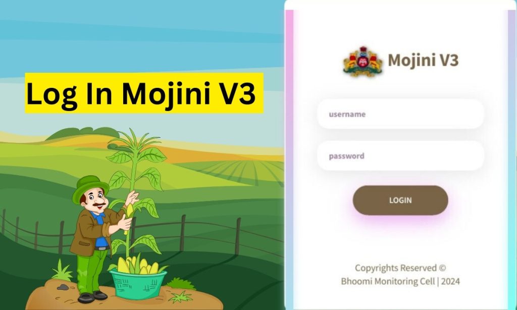
How To Log In Mojini V3
After successful registration, to login Mojini V3 is as easy as follows:
- Visit the Mojini login page via their official platform website. That is https://landrecords.karnataka.gov.in/citizenportal/
- Enter your username, password and live captcha.
- Then tap on the Login button to access your account and use the appropriate service.
Download Mojini App
To Download and access Mojini app on your devices you have to follow these steps which are:
- Visit playstore or appstore and search for ‘Mojini’.
- When the app appears click on the install button and wait for the installation process.
- After installation, launch the app.
- Once the app is opened. You will see the following options given below:
- Download Village Map
- View Mojini Request Status
- View Survey Documents
- Now, Choose from the options given above.
- Click on the options and then filled the required information
- After filling out the information, You will get the results.
Mojini v3 Status For Application
You can check the mojini v3 application status of yours in three different ways that we have mentioned below:
With Application Number
- Go to the official website
- Click on check status
- Type application number and click get status.
- Choose the track status icon and get the details of your application status.
Via Mobile Number
- You have to follow the same steps as above. But, this time you have to select “with mobile number”.
- Then enter your mobile number and get the detailed status on your screen.
By Using Survey Number
- While checking status with a survey number you have to go with this option that you will find your screen.
- Then, you have to mention your District, Taluk, Hobli and Village.
- After that, select Surnoc, and Hissa no, and get your application status.
Features Of Mojini V3
- V3 Revenue Village Maps: To have a visual idea of the village and land availability, this component can be used.
- 11E Sketches: This is required to check whether the land details are entered correctly when you go for property verification. This can also be used for planning your construction as well with an idea of the layout measured.
- Application Status Tracking: You can Track your application status using this component.
- e-SWATHU Sketches: Use this component if you need detailed boundaries with digital records.
Benefits Of Mojini V3
Mojini V3 provides several benefits to its users which are as follows:
- Easy To Access: Due to the digital nature of the platform, all information related to land is transparent and easily accessible within reach of the public. Therefore, it also helps in reducing fraud cases that are often involved in land transactions.
- Saves your Time: Applicants can access required documents as well as check on the status of their applications online, saving their precious time and costly journeys to government offices in particular cases where the user is based very remotely.
- 24/7 Availability: It is convenient for users to access the land-related information at 24/7 with internet access. This feature is beneficial for the user that needs data immediately which is time-consuming and he/she cannot wait after office hour to search for particular data.
Conclusion
Mojini V3 is a great step toward efficient and transparent land record management in Karnataka, by making the land records easily accessible to landowners/buyers/stakeholders. From accessing land sketches, tracking status of an application, downloading revenue maps etc., all these services are offered through Mojini on your devices. With Mojini Government of Karnataka has set another example in terms of modernization of Land administration process – Promoting user friendly application, Transparent mechanism and ensuring efficiency too which would contribute for overall development of Land resource in the state.
Frequently Asked Questions ( FAQ )
Ans. The main focus of Mojini is to help people to maintain their land ownership details and records in a more simplified way so that anyone can take benefits by accessing them digitally.
Ans. Yes, with the help of Mojini you can track your land application status online just by entering your details.
Ans. Mojini lets you view 11E sketches, Alienation Sketches and Phodi sketches respectively.
Ans. Those people who want to access land related information such as landowners, buyers, researchers, sellers, etc can also take benefits from it.
Read More Usefull Article Below